Not all beaches are considered equal.
Some stretches of coastline, like in south Orange County, are thin and shrinking, a well-reported worsening each year.
But, to the surprise of even the experts, other areas of California’s coast are actually growing, with widening beaches that have made the state about 500 acres bigger than it was 40 years ago.
A new study released by UC Irvine and the United States Geological Survey used NASA satellite data and newly developed measuring techniques to track coastal changes. The study was funded by NASA and USGS and recently published in Nature Communications.
“This is a counterintuitive finding considering previous reports of widespread beach erosion in Southern California,” said co-author Brett Sanders, UC Irvine professor of civil and environmental engineering. “While several individual beaches did experience severe erosion, there were also several that experienced dramatic widening.”
The research analyzed shoreline changes across California from 1984 to 2024. It found that Southern California beaches generally expanded by about 10% during this period, even as dams and urban development were expected to starve coastlines of sediment and accelerate erosion.
An overall trend shows widening at an average of more than 23 feet in those 40 years across nearly 200 miles of Southern California coastline.
Nearly 50% of the coastline showed significant widening; however, 31% experienced narrowing. Doheny, San Clemente and San Onofre beaches experienced some of the region’s most severe erosion, with the sand space narrowing at rates exceeding more than 3 feet per year, shrinking valuable recreational space and causing damage to public and private property, according to the report.

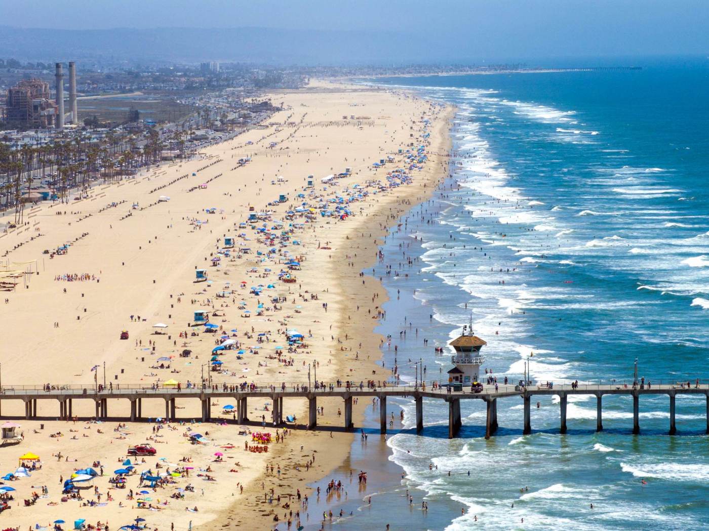
Some of the most rapidly widening beaches, which include Huntington Beach and Venice Beach, are more than 600 feet wide, locations that benefit from sediment trapped by coastal structures such as harbors or jetties or accumulating in natural “sand convergence zones.”
“It’s places like that, those are winning out. Those are the places that result in all this added beach, all this added sand building up on our coast,” said lead author Jonathan Warrick, research geologist at the U.S. Geological Survey’s Pacific Coastal and Marine Science Center.
But where a harbor, dam or other coastal structure can build up sand along some beaches, it often means the sand isn’t being distributed to other stretches of shore, and that loss of natural flow is leading to erosion issues, Sanders said.
“The primary challenge facing Southern California beaches is not sediment shortage, but sediment distribution,” Warrick said.
The assumption was that beaches were shrinking due to the amount of sediment trapped inland in dams and erosion at the shore.
“We naturally assumed that would result in beaches shrinking,” Warrick said. “We have had sea level rise, big storms over the years. We know there are areas that have been eroding. We had been assuming Southern California beaches would just be eroding, but measurements proved otherwise. It was really eye-opening to all of us when we started looking at data.”
The research highlights opportunities for improved coastal management and sustainability, the authors said. Rather than sediment shortage being the fundamental problem, the study suggests that strategic redistribution of existing sediment could address localized erosion.
“There’s new opportunities to think about using sand more efficiently and better. I think there’s cool opportunities,” Warrick said. “It’s become a really important data source, where we didn’t have data before.
“It’s really hard to make decisions without good information,” he added.
Several Southern California harbors, including Santa Barbara, Ventura and Channel Islands/Port Hueneme, already operate “sediment bypass systems” — like dredging — to move sand past barriers such as jetties and breakwater structures. There’s long been such a system in place at the Santa Ana River, with sand taken out and moved to fill in between the jetties in Newport Beach.
Expanding such efforts could provide “more equitable, widespread and natural use” of sediment resources at shorelines, the study’s authors said.
Areas of Sunset Beach, Huntington Beach and Newport Beach are examples where beach nourishment projects have resulted in wider beaches.
Huntington Beach is wider because it’s downcoast from Sunset and Surfside, where for decades a sand replenishment project has added offshore sand.

“The gains occurring in Santa Monica and Venice are resulting in erosion down the coast,” Warrick gave as another example. “There are human fingerprints in all this.”
Oceanside Harbor is a big coastal structure that impacts sand flow down the coast, requiring nourishment elsewhere to keep affected beaches healthy.
“Every beach is different,” Sanders said. “Every erosion hot spot is a place you can look closely and see complex patterns of sediment movement. When you step back and look at the whole Southern California coast, just about all of the hot spots are close to a coastal structure.”
Just last week, Sen. Alex Padilla announced securing $1 million in federal funding toward identifying and evaluating modifications to flood channels and dams, and their operations, to increase natural supplies of sand to area beaches during storm events.
“We may want to consider how to do that type of work better, more efficiently, maybe using the information we have to better place it, get it to the places it’s needed,” Warrick said of sand projects.
The study acknowledges there are barriers that exist to improved sediment redistribution, including “financial costs, regulatory processes, institutional inertia, political boundaries and resistance to change.”
“The sand is just not where we need it to be to have a nice even distribution,” Sanders said. “Ideally, we would have sand in all the places we need it, and that’s just not what’s emerged today in this more urbanized coastline. But it does point out that there is enough sand in the region.”
The access now available to the satellite and wave data, “substantially improves our ability to monitor beaches and to explain why some are widening and some are narrowing. This, in my mind, is a game-changer for coastal management,” Sanders said.
What if policymakers had previously had access to this nearly real-time data, without having to rely on expensive surveys requiring planes flying overhead or piecing together local studies for a broader view, Sanders asked. “Imagine if we had this 20 years ago, and we saw San Clemente narrowing. That would have given policy makers strong evidence of how fast (beaches) were narrowing, where, and which were the most deserving of action.”
“Now we can monitor beaches several times a month with satellites,” Sanders said. “Really, we now have the ability to monitor the beach on a week-to-week basis to see how beaches are changing. It gives us a better ability to see problems emerging and prioritize responses.”